Intent/Goal:
To have a map resource that allows for daily interactions with constantly changing concepts/content in an AP Human Geography class for a student who is blind.
Challenge faced:
10th grade AP Human Geography class uses an exorbitant number of visual maps to relay various concepts: fertility rates, poverty rates, population rates, etc. I wanted to create something that could relay this same information tactually, but without the extremely time-consuming process of creating a tactile graphic for each visual map. In addition, my student needed lots of exposure with her mapping skills in general and I thought an interactive tactile map that she could use independently, with peers, and her teacher (when I was not available) would be far more helpful in her acquiring these necessary skills. I wanted to have a way to increase/decrease the tactile clutter on one “living” resource for ease of access and familiarity.
Highlights:
- large world map that typical peers use (ordered on Amazon, low cost)
- various sizes can be utilized: hang on wall, use at home, use at desk
- promotes typical social interactions by being visual, yet easily adaptable
- allows for teacher-student interaction with ease
- promotes consistent, routine exposure of mapping skills (knowledge of continents in relation to each other; knowledge of different oceans in relation to each other, etc.)
- can replace use of several smaller tactile graphics, though they have an important role in geography
- can be used with APH World Map book for zones in regions and other details
Process:
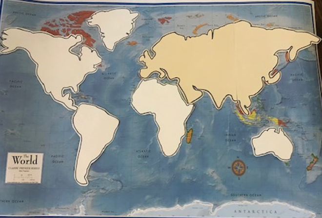
- I took a laminated 24×36 world map and created tactile overlays for all 7 continents. [via Amazon.com: 24×36 World and USA Classic Premier 3D Two Wall Map Set (Laminated)]
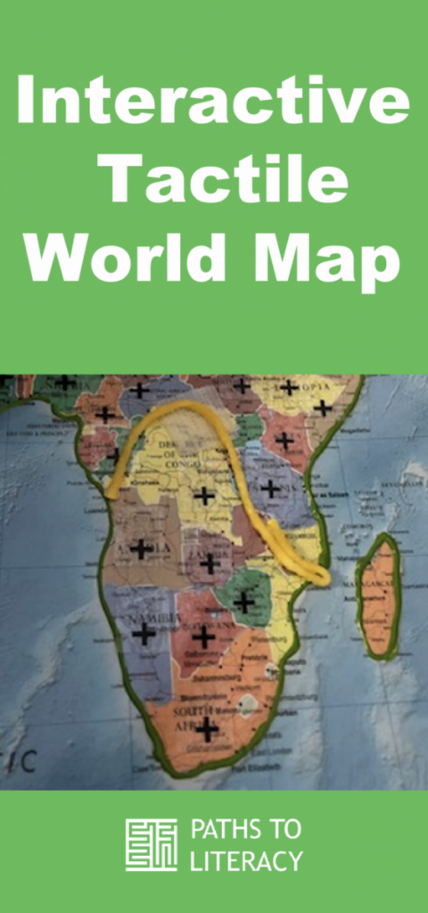
- I traced the outline of each continent using tracing paper. I then created an outline of same continent on Thermoform paper, cut it out, and ran it through my Thermoform machine. I attached Velcro to the back of each cutout, tactile continent for placement on the laminated map. Each overlay has a simple print/braille label indicated the name of the continent. In the image below, the green outline of Africa is puffy paint (which I used to outline the continents) and the yellow is made with Wikki Stix to mark a delineation between two regions. I like the Wikki Stix for the changeable data since it is easy to add/remove.

- Before I attached each overlay, I used puff paint (my student is at an all-girls school and would enjoy the fun pops of color, but of course a hot glue gun could be used as well) to make the outline of each continent tactile.

- With the overlays now in place, my student can explore the entire world map and get her bearings with minimal tactile input to interpret. When the teacher is focusing on one continent/region for a specific concept, my student can find that continent, remove the overlay, and zone in on more specific countries (by name, by location, etc.).
- I also bought a large wall-size laminated map that hangs in my student’s classroom for all her peers to utilize as well.
Variations
*This resource could also be adapted further to be appropriate for students with low vision and students with CVI.